How to Access Weather Data by Postal/Zip Codes
Real-Time Weather Data
- The Value of Real-Time Weather Data and Chipkin's Servers
- How to Access Weather Data by Postal/Zip Codes
- Modbus Weather Servers and Weather Condition Enumerations

Canadian Postal Codes and USA Zip Codes
Chipkin's weather data is based on Postal/zip codes. To get a clear understanding on how to use the servers and their limitations, it is good to understand how postal/zip codes represent geographic regions.
Canadian Postal codes are comprised of 6 characters, e.g. V5Y 4R3. The first segment is called the 'forward sortation area' (FSA) and is used to identify the geographic location of the address. The first character of the FSA represents the 'postal district', which splits the country into major geographic regions – for example, 'N' is used for all South-Western Ontario and 'V' is used for all British Columbia.
Chipkin's weather service is based on the FSA segment.
The second character is used to separate rural and urban regions. The number '0' denotes a rural region with numbers 1 through 9 representing urban areas. It's common for rural regions to be 'urbanized', which involves the changing of the '0' to another number. The third character is used to more precisely describe the geographic area of the address.
The second segment is called the 'location delivery unit' (LDU) and represents either a specific address or group of addresses. Sometimes an LDU covers an entire city block, all (or part) of a high-rise, a small rural community or even a single house. Chipkin's weather service does not use this segment.
USA Zip codes function similarly to Canadian Postal Codes, but are comprised of 5 numeric digits. The weather data supports Zip Codes from major Metropolitan areas. Some geographic areas are huge, and many sub-climates may be found in one zone.
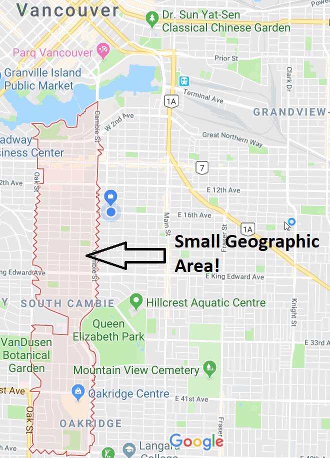
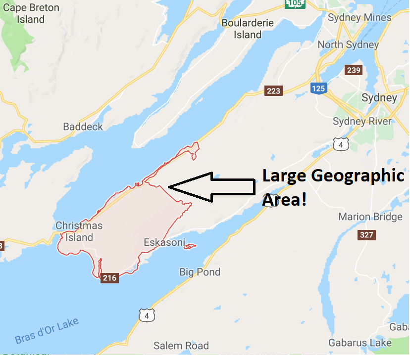
Below is a Canadian Example of some of the limitations of our weather data. It is dependent on the geographic area covered by a single Postal/Zip code. If you look a metropolitan area with high density of buildings, a large number of postal/zip codes will support a smaller geographic area, thus a single Postal/Zip code will generally have the same weather conditions throughout. But, if you look at a rural area where a single postal/zip code will denote a large geographic area, then within a single code, there may be different weather. Thus, the weather data will not be very useful. As an example, this data will not be useful for a rural area like the countryside of Nova Scotia will, but if you look at major metropolitan areas say Toronto, then the data will be very accurate.